Till
Lake
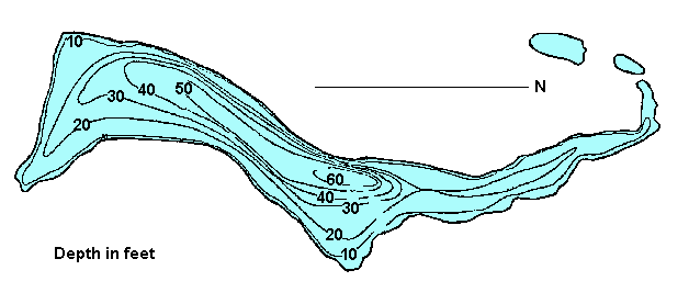
Click
on the lake icon at the right to see full bathymetric map.
Click on the moose on the left for complete BC travel information.
Location:
At Williams Lake turn west
onto Highway 20. Cross the Fraser River and travel up the Sheep
Creek Hill. At the top of the hill turn off Hwy 20 onto the Meldrum
Creek Road (about 32 km / 19.8 miles west of Williams Lake). Follow
this road for about 13.2 km (8.2 mi) and then turn left onto a gravel
road for 2.5 km (1.5 mi) to reach the lake.
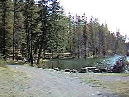
Resorts
& Campsites:
There is a large treed BCFS campsite accessible to cars, campers
and small RV's. Boats can be launched and there is good swimming
at this site.
BC Adventure Network members serving this area:
If you would like to have your business listed, please Click Here.
Fishing
Report: Till is a rainbow stocked lake with reports
of 6 pound fish being caught. Till is subject to winterkill. Phone
local Fly & Tackle shops for up to date info. Be sure to visit Fishbc.com
for angling information!
Viewscape:
Situated on a plateau with sandy soil and a heavy growth of spruce
and pine. The lake is a glacial blue/green color, but it is not
from glacial till.
Shoreline:
Data Not Available
Nearby
Lakes
Buckskin
Lake - Follow the Meldrum Creek Road past Till Lake
for approx 20 km (12.4 mi). A small aerated lake, Buckskin is
reported to be a good producer of 4 to 5 lb rainbows on the
fly.
Note:
Always check your current BC Fishing regulations before you start
fishing a new lake.


 Resorts
& Campsites:
There is a large treed BCFS campsite accessible to cars, campers
and small RV's. Boats can be launched and there is good swimming
at this site.
Resorts
& Campsites:
There is a large treed BCFS campsite accessible to cars, campers
and small RV's. Boats can be launched and there is good swimming
at this site. 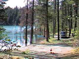 Shoreline:
Data Not Available
Shoreline:
Data Not Available