BABINE
MOUNTAINS RECREATION AREA
The Babine
Mountains Recreation Area provides the visitor with varying terrain
perfect for snowmobiling, skiing and snowshoeing. The Babine Mountains
are the winter range for mountain goats. The area is located east of
Smithers off of Highway 16. There are four main areas for smowmobilers
to enjoy and numerous skiing and snowshoeing routes.
CARP LAKE PROVINCIAL PARK
The park area covers more than 19,000 hectares including Carp Lake,
War Lake and numerous other lakes and streams making water activities
the most popular pastime within the park. At McLeod Lake, 141 kilometres
north of Prince George, turn off the John Hart Highway #97. It is 32
kilometres to the Carp Lake Campground. Two campgrounds offer a total
of 102 sites, as well as wilderness camping. Trails connect with Rainbow
Lake, McLeod River and two of Carp Lakes beautiful sandy beaches.
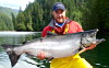
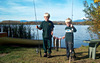
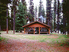
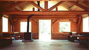
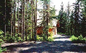
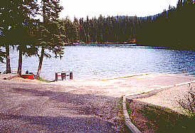
CROOKED RIVER PROVINCIAL PARK
The beautiful Crooked River Provincial Park is located on the Hart
Highway #97, 70 kilometres north of Prince George and offers many popular
sandy beaches. Crooked River, Squaw Lake and Hart Lake are popular with
both canoeists and anglers. There is a 90 unit campground within the
park and nine kilometres of trails where outdoor enthusiasts can discover
the beautiful area and its abundant wildlife.
Photo 1 | Photo 2
| Photo 3
DRIFTWOOD CANYON PROVINCIAL PARK
Located 10 km (6 mi) east of Smithers off of Highway 16, the park
is home to ancient fossil beds which were created by a shallow ocean
millions of years ago and are exposed in the creek banks today. Picnic
and day-use facilities are provided.
ETHEL F. WILSON PROVINCIAL MEMORIAL
Located north of the community of Burns Lake on Pinkut Lake, this
small camping and day-use area draws anglers to its exceptional rainbow
trout fishing oppurtunities. A boat launch is provided and the park
is open from May to October.
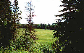
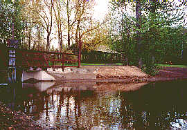
ESKERS PROVINCIAL PARK
This park is an exceptional day-use destination. Eskers Provincial
Park encompasses 1600 hectares of gently rolling terrain including a
portion of the 40 kilometre long Stuart River Eskers Complex. The park
is located 40 kilometres north of downtown Prince George. Turn left
off of the North Ness Lake Road onto the Pine Marsh Road. A canoe launch
is located at Circle Lake. There are 10 kilometres of marked trail linking
Pine Marsh, Camp Lake and Kathie Lake. There are a number of trails
available for cross-country skiing and snowshoeing within the park during
winter. Photo 1 | Photo
2 | Photo 3
EXCHAMSIKS RIVER PROVINCIAL PARK
Located off of Highway 16 southwest of Terrace near where the Exchamsiks
River joins the Skeena River, this park provides the visitor with a
campground and day-use/picnic area. The old-growth Sitka spruce forest
provides a relaxing setting where the visitor may try his luck for salmon,
explore the area via an extensive trail system or by waterway. The park
isd open from May to October.
FINGER-TATUK PROVINCIAL PARK
Finger-Tatuk Provincial Park is located 80 kilometres south of Vanderhoof
and 115 km southwest of Prince George. Finger-Tatuk Provincial Park
features a beautiful series of lakes and is a regionally significant
recreational destination. The park surrounds Finger and Tatuk Lakes
and extends south to include the smaller Turff, Vance, Cory, Bodley,
and Harp Lakes south of the Tatuk Hills. Abundant populations of Rainbow
Trout and Kokanee are the main attraction for anglers in the area. Guided
and resident hunting and boating are also popular pursuits.
KHUTZEYMATEEN/K'TZIM-A-DEEN GRIZZLY BEAR SANCTUARY
This park is an exceptional day-use destination. Eskers Provincial
Park encompasses 1600 hectares of gently rolling terrain including a
portion of the 40 kilometre long Stuart River Eskers Complex. The park
is located 40 kilometres north of downtown Prince George. Turn left
off of the North Ness Lake Road onto the Pine Marsh Road. A canoe launch
is located at Circle Lake. There are 10 kilometres of marked trail linking
Pine Marsh, Camp Lake and Kathie Lake. There are a number of trails
available for cross-country skiing and snowshoeing within the park during
winter
KINASKAN LAKE PROVINCIAL PARK
The park is located south of Dease Lake community on Highway 37
and provides the visitor with a fully facilitated, 50 site campground,
a boat launch, excellent swimming beaches and extensive trails to explore
the surrounding area from. The lake provides the avid angler with excellent
oppurtunity for rainbow trout.
LAKELSE PROVINCIAL PARK
The Lakelse Provincial Park encompasses two seperate areas on the
north and east shores of its namesake lake. The waterways of the park
are noted for their excellent swimming and fishing. The park is located
25 km south of Terrace and 40 km north of Kitimat. Access to both sections
of the park are possible from Highway 37, 20 km south of Terrace. Trails
provide access to various beaches, picnic areas and notable features
of the area.
NAIKOON PROVINCIAL PARK
Here on the north eastern part of the Queen Charlotte Islands lies
the Naikoon Provincial Park encompassing 72,640 hectares of Graham Island.
The islands are accessible by scheduled flights from Vancouver and Prince
Rupert and by BC Ferries between Prince Rupert and Skigegate. Agate
Beach Campground has 43 units and Misty Meadows Campground has 30 units.
There is wilderness camping permitted throughout the park and three
rustic shelters are provided.
NISGA'A MEMORIAL LAVA BED PROVINCIAL PARK
This park is the first of BC's to be jointly managed by BC Parks
and the Nisga'a Tribal Council. The Nisga'a Memorial Lava Bed Provincial
Park commemorates the devestation of of two Nisga'a villages and more
than 2000 Nisga'a deaths 250 years ago during a volcanic eruption. The
18,000 hectare park allows the visitor a chance to learn more of the
Nisga'a cultural heritage and the natural history of BC's volcanic landscape.
The lava plain is located in the Nass Basin Landscape, 100 km north
of Terrace on the Nisga'a Highway.
PAARENS BEACH PROVINCIAL PARK
Located just south of Fort St. James on the shores of Stuart Lake,
one of BC's largest lakes, this park offers the visitor a campground
with facilities, excellent angling oppurtunities and the perfect site
for water sports of all kinds. Open from April to October.
PURDEN LAKE PROVINCIAL PARK
This 140 hectare park is located on the north shore of Purden Lake.
The park is located in the Fraser Basin 64 kilometres east of Prince
George on the Yellowhead Highway #16. Visitors will find a remarkably
diverse range of vegetation on the glacial drift that blankets the landscape.
The campground consists of 78 sites including 7 double units and 12
tent sites. Photo 1 | Photo
2
RED BLUFF PROVINCIAL PARK
The park is located 45 minutes north on Highway 16 at Topley. Babine
Lake is BC's largest natural lake and an anglers paradise where cutthroat
trout, rainbow trout and char are resident. Flyfishing and trolling
are popular methods used. A 64 unit campground is provided with a beach,
boat launch and moorage floats located nearby. The scenic reddish cliffs,
abundant wildlife species and salmon enhancement projects in the nearby
Fulton River and Pinkut Creek are just some of the parks features.
SEELEY LAKE/ROSS LAKE PROVINCIAL PARKS
The parks are located halfway between Prince George and Prince
Rupert. Angling in either of the lakes for cutthroat and rainbow trout
are popular pastimes. The Hazelton Mountains provide a majestic backdrop
to the area. Visitors may wish to canoe through the lakes, hike the
numerous trails, enjoy the beach and picnic areas or relax in one of
the 20 campsites. Nearby Old Hazelton is home to K'San, a reproduction
of a Gitskan Indian village. Traditional dances are performed here during
the summer months.
SPATSIZI PLATEAU WILDERNESS PARK
Created in 1975, Spatsizi Plateau Wilderness Park that includes Gladys
Lake Ecological Reserve is the second largest park in British Columbia.
The park encompasses an area over 3600 square miles and can be reached
off the Stewart-Cassiar Highway. It takes in three major vegetation
zones: alpine tundra, spruce-willow birch, boreal white and black spruce
forest. Spatsizi Plateau and Eaglenest Range form the two broad physiographic
regions. The Plateau ranges from 1600 m to 2000m, while the Eaglenest
Mountains are rugged, steep and the highest peak is 2500m. Both the
Spatsizi and Upper Stikine provide the river drainage.
STIKINE RIVER RECREATION AREA
The Stikine River Recreation Area encompasses one of Canada's unmatched
geological features. 80km of vertical sedimentary and volcanic rock
canyon winds its way through the area giving home to the unnavigable
Stikine River. This grand canyon is located in the rainshadow of the
Coast Mountains. The recreation area is located on Telegraph Creek Road,
110 kilometres from Dease Lake. Extensive trails and a boat launch allow
a pleasant combination of hiking and angling.
TWEEDSMUIR NORTH PROVINCIAL PARK
The Tweedsmuir North Provincial Park is the largest in BC, encompassing
more than 981,000 hectares. Water access from the Ootsa-Whitesail Lake
Reservior is the most popular method of entry to the park. Boat launches
are accessible by roads from the communities of Vanderhoof, Burns Lake
and Houston. Charter float planes are available from Smithers and Burns
Lake. Wilderness camping is permitted in designated areas. Anchorages,
tent sites, toilets and fire rings are provided. Extensive trails lead
the nature enthusiast to the parks smaller lakes, notable features and
vantage points.
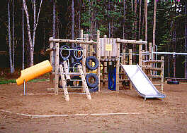
TYHEE LAKE PROVINCIAL PARK
This 33 hectare park is located in the Bulkley River Valley 16
km from Smithers and 2 km from Telkwa. The 59 unit campground provides
water, wood and toilets. A picnic area and playground are located conveniently
nearby. This lake is popular with boaters, waterskiiers and anglers.
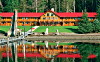
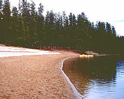
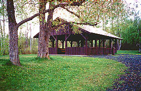
WEST LAKE PROVINCIAL PARK
This 256 hectare park offers outdoor adventure year-round; hiking,
boating and swimming in the summer, cross-country skiing, snowshoeing
and tobogganing in the winter. The park is located 22 km southwest of
Prince George on the West Lake Road. The expansive, sandy beaches of
West Lake are the perfect place for a picnic or just to relax. Changehouses,
fire pits and picnic tables are located nearby. An extensive 15 km trail
system winds through the park making it a haven for cross-country skiers.
Photo 1 | Photo 2 |
Photo 3
WHISKERS POINT PROVINCIAL PARK
The park is found on a secluded peninsula reaching into historic
McLeod Lake. This area was once admired by explorer Simon Fraser who
established Fort McLeod in 1805. The park is the perfect base from which
to explore the area. It is located 130 kilometres north of Prince George
on the Hart Highway #97. The campground is located on the sandy point
of the peninsula and features 69 private sites. A nature trail loops
through the woods to the campground.
